

What is GIS?
Geographic Information Science (GIS) merges the power of geography with innovative information technology. GIS allows you to visualize, analyze, and interpret data spatially, offering manifold possibilities across industries.

Why take courses in GIS?
- In-Demand Skills: GIS is at the forefront of modern technology, and industries worldwide are seeking professionals with GIS skills. For example, GIS can be integrated into web and AI applications.
- Versatility: Whether you’re interested in urban planning, environmental science, business analytics, or disaster management, GIS skills apply across a wide range of professions.
- Problem-Solving: GIS equips you to analyze complex spatial data, enabling informed decisions. Enhance your problem-solving skills and contribute meaningfully to projects that impact the world.
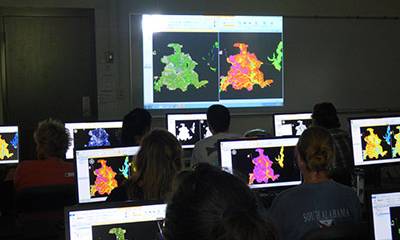
- Hands-On Experience: Our GIS program provides hands-on experience with industry-standard software, ensuring you are ready to apply your skills in real-world scenarios from day one.

Who should pursue a GIS minor or certificate?
At the University of South Alabama, students can incorporate GIS courses into their college careers through the Minor in Geographic Information Science & Technology (GIST), a GIS certificate at either the undergraduate or graduate level, and a GIS concentration within the Master of Public Administration curriculum. While in the program, you will benefit from career guidance and numerous opportunities for internships with local stakeholders or research projects with on-campus faculty.
Program Structure
Geographic Information Science & Technology (GIST) Minor
A GIST minor is a strong complement for many college majors because it equips students with highly sought-after technical and analytical skills. The program consists of six courses (24 hours).
| Course | Credits |
|---|---|
| GIT 460 Intro to GIS (required) | 4 |
| GIT 455 Geospatial Programming (Required) | 4 |
| One of the following: (Required) GIT 461 Environmental GIS GIT 462 Web Mapping and Business Analytics |
4 |
| Electives – take three electives. See the current University Bulletin for a list of approved courses. |
Geographic Information Sciences Undergraduate Certificate
A GIS Certificate, in concert with a degree or completed on its own, provides you with a skill set that distinguishes you from other candidates, with the ability to apply technical knowledge to real-world problems like optimizing transportation routes, planning disaster responses, mapping underground infrastructure, and making informed decisions on development and regulations. A GIS certificate can be earned in addition to a GIST minor.
| Course | Credits |
|---|---|
| GIT 442 Remote Sensing* | 4 |
| GIT 450 Digital Mapping & Visual Display* | 4 |
| GIT 460 Intro to GIS* | 4 |
| GIT 461 Environmental GIS* | 4 |
| GIT 462 Web Mapping & Online GIS Applications* | 4 |
| GIT 463 GIS for Business and Urban Analysis* | 4 |
*To earn the certificate, students must earn at least a "B" in each of the six courses that make up the GIS Certificate.
Geographic Information Sciences Graduate Certificate
Students pursuing a Graduate GIS Certificate must complete four courses totaling 16 credit hours from the list below, including the required GIT 560: Introduction to GIS.
| Course | Credits |
|---|---|
| GIT 560 Intro to GIS* (required) | 4 |
| Choose three of the following | |
| GIT 542 Remote Sensing* | 4 |
| GIT 550 Digital Mapping & Visual Display* | 4 |
| GIT 561 Environmental GIS* | 4 |
| GIT 562 Web Mapping & Online GIS Applications* | 4 |
| GIT 563 GIS for Business and Urban Analysis* | 4 |
*To earn the certificate, students must earn at least a "B" in each of the six courses that make up the GIS Certificate.
How to Apply to Earn the Certificate?
Students apply for the certificate upon completion of the required coursework. No
enrollment is required.
Please fill out this form during the semester in which you complete your last course(s) for the GIS Certificate and submit it to the Department of Earth Sciences or email it to Dr. Steve Schultze at schultze@southalabama.edu. To receive the certificate, you are responsible for notifying the Department of Earth Sciences. The form must be submitted at least two weeks before the end of the semester.
For questions, please contact the GIS Program Coordinator, Dr. Steve Schultze.
Dr. Steve Schultze
Professor, Geography & GIS
Department of Earth Sciences
(251) 460-6381
schultze@southalabama.edu